

A near-flat six-minute walk from the east end of Victoria St all the way to Stanley St? Walking, or biking, through tunnels under Albert Park, with lifts up to the universities. It could happen, writes Greater Auckland’s Matt Lowrie.
Auckland’s hills help to define our city. Sometimes they’re a blessing, sometimes they can be a bit of curse. Occasionally they also present a unique opportunity. Nicolas Reid, who regularly comments and sometimes posts at Greater Auckland, has been part of a group working recently to unlock one of those opportunities: the Albert Park tunnels. Reid and long-time advocate Bill Reid (no relation) presented their plans this week to the City Centre Advisory Board. They’re calling the project Te Ara Tomo: The Underline, and here’s what they propose.
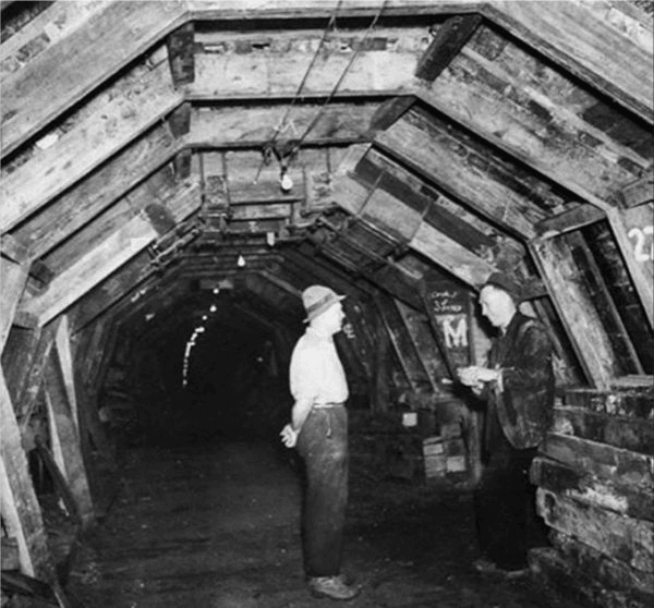
The idea is to open up the and restore the tunnels that were dug under Albert Park during WW2 as an air-raid shelter. Following the war, they were backfilled with clay blocks and sealed.
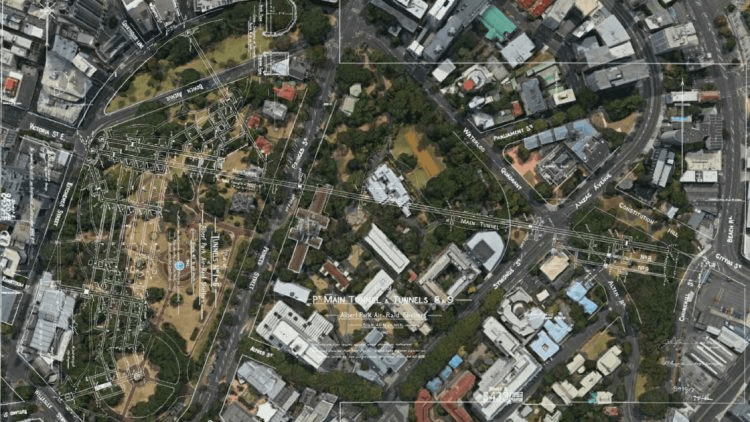
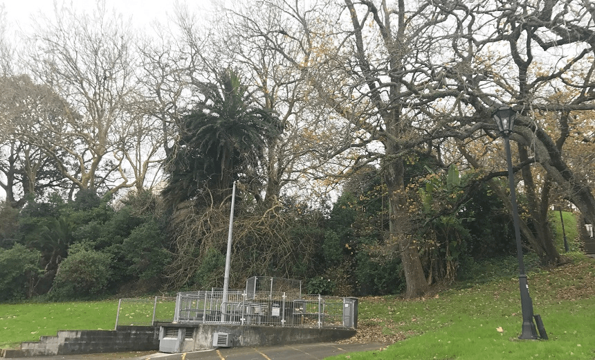
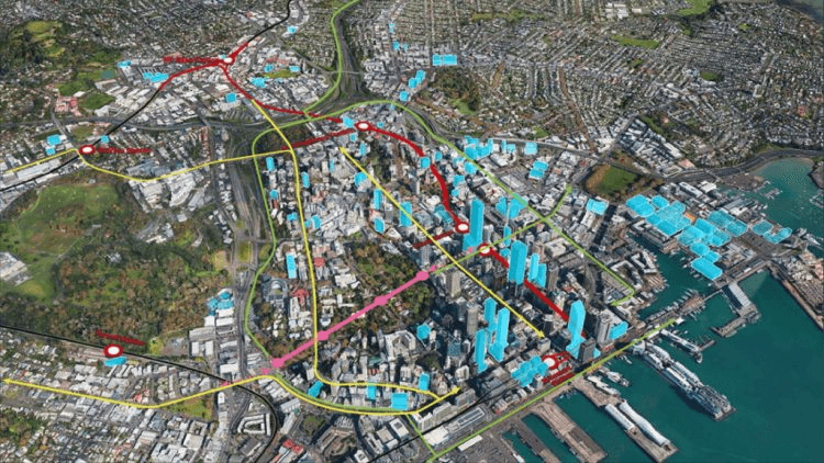
The main tunnel runs 660 metres, all the way from the eastern end of Victoria St through to Churchill St, overlooking the Stanley St intersection where the motorway ends and the tennis courts are sited (the entrance is currently hidden in the undergrowth in our feature photo). That tunnel is 4.4 metres wide and 3 metres tall. There are a lot of smaller tunnels off it, too. So, why not make use of them?
The basic concept is to re-open the tunnels and turn the main tunnel into a walking and cycling route with connections to the University via some lifts. Doing so would provide a much easier, grade than up and over Symonds St and Albert Park while improving connections from the City Centre to locations such as Parnell. They’ve called this Te Ara Tomo – The Underline and is shown below.
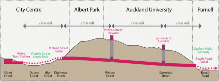
Importantly, it would link in perfectly with existing and planned walking, cycling and PT networks. For example, it would create a new cross-town cycle link, connecting the Grafton Gully cycleway into the Victoria St Linear Park, which is also happens to be connected through Queen St where Light Rail will one day run and to the future Aotea Station. The lifts at Symonds St would also hook into the Symonds St buses.
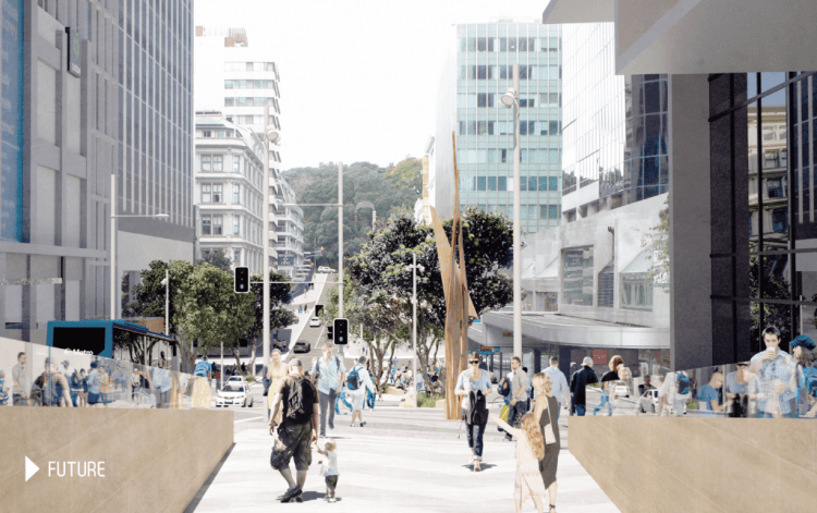
This just gives another reason as to why it’s important we preserve the Victoria St Linear Park and not accept Auckland Transport running bus routes along the road.
And there’s no shortage of potential users of the concept. Here are some from their presentation.
40,000 students at University of Auckland
- Approximately 30,000 on any given day
- Over 70% currently walk, cycle or take public transport to campus
- 13,000 a day walk to and from campus from bus, train, ferry stops in town
- Many more walk from apartments and flats in town, Carlaw Park, Parnell.
100,000 commuters to City Centre
- approximately 50% walk, cycle or public transport, many potential trips:
- 400 people live in Parnell and walk to work midtown each day (Census 2013)
- 1000s catch eastern bus routes and walk back up from Britomart
50,000 residents live within in the City Centre
- and they walk everywhere.
Plus local and international tourists, day trippers, recreational cyclists…
Given the potential it offers, they’ve estimated that conservatively, it could see 3,000-3,500 entries per weekday or over 750,000 per year.
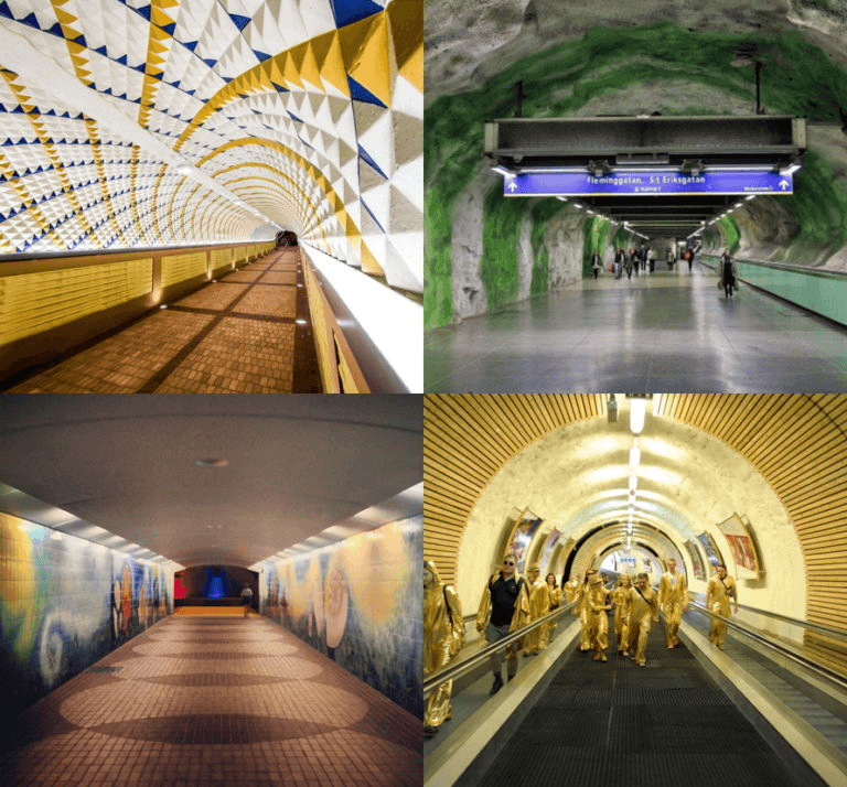
As part of opening up the tunnels it also provides an opportunity to turn it into a piece of urban art with a new lining. Some examples from overseas include:
While the walking and cycling through the main tunnel is the key concept, it’s not the only one. There are after all 3.5km of tunnels under there. Some possible ideas for use include:
- Historical displays and a mini museum
- Art displays
- Tourist and retail opportunities, such as:
- a wine cave, showcasing New Zealand wines at “cellar door”
- a cheese cave, showcasing some of New Zealand’s premium dairy products
- a Waitomo Caves style glowworm encounter
By now you might be asking just what this is going to cost. They say McConnell Dowell have prepared some costs to reinstate the tunnels and install the lifts, lighting etc. They say the main tunnel and lifts would cost around $14 million, an extra $2-3 million for additional space for the other ideas mentioned above, and $1-2 million for planning, consenting, traffic management and tunnel surfacing. All up it would be around $17-19 million. They are also looking at doing this commercially with users paying a small fee to use the tunnels, along with money from the other activities.
To me, even if just looking the project from a walking and cycling perspective, the cost seems pretty reasonable given how useful it would be. It would also add to other iconic cycleways the city is building including Lightpath, Skypath and Glen Innes to Tamaki Dr (hopefully alongside the rail line through Hobson Bay).
Overall this seems like a great project and one the council should quickly look to add to its plans as it reviews and refreshes the City Centre Master Plan and the other plans.
This post originally ran on Greater Auckland
The Auckland section is sponsored by Heart of the City, the business association dedicated to the growth of downtown Auckland as a vibrant centre for entertainment, retail, hospitality and business.