


The planners and designers behind the proposed Queensway park project provided an update to a packed auditorium recntly as part of Open House New York‘s Projects in Planning series.
Their plea is urgent – they want to convert a 3.5-mile stretch of abandoned rail track in central Queens to a linear park. But just last year, the MTA announced it is studying the feasibility of returning the abandoned railway to service as a subway line. The results of that study are due this June.
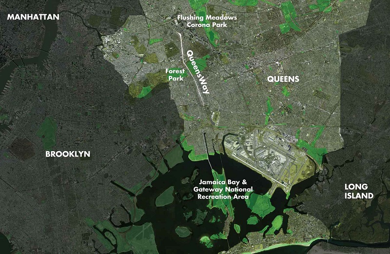 Photo credit: Friends of the QueensWay
But local residents and elected officials are conflicted. While much of the area is far from transit, it is also severely lacking in park space.
The idea for the Queensway came about in 2011 among a group of concerned neighbors. Since Long Island Rail Road abandoned the spur in 1962, the route has become a dumping ground and a magnet for crime. They enlisted the help of the Trust for Public Land and began setting out to sell the project as, yes, a High Line for the outer boroughs.
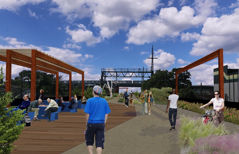 Photo credit: Friends of the QueensWay
Just don’t take the comparison too far. The organizers are quick to point out the Queensway will be 2.5 times longer than the High Line, and much wider at parts, with space even for ball fields among its 47 acres. The project’s defiant contrast to its flashy Manhattan forebear is seemingly apparent even in its name, as if to say, “we’re doing it the Queens way.”
As envisioned, the Queensway will consist of four larger gathering and activity centers along its stretch, connected by narrower passages that will serve to move visitors quickly along so as to respect the privacy of neighboring homeowners (who apparently aren’t as attention-starved as the High Line’s infamously exhibitionist neighbors).
Join Untapped Cities, the Trust for Public Land and Friends of the Queensway for an urban exploration tour of the Queensway this spring:
Behind-the-Scenes Tour of the Queensway
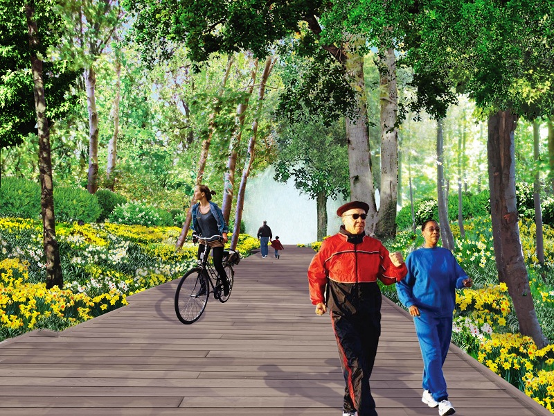 Photo credit: Friends of the QueensWay
In order to stay flat on a hilly landscape, the rail path is sunken in a trench in some places, and raised on a berm or on a viaduct structure in others. At certain treeless points in the south, one can see all the way to Coney Island beyond Jamaica Bay. The landscape architect, DLANDstudio, wants to keep as much of the existing site conditions in place – fifty-year-old trees, rusted train tracks, even old telegraph poles.
The project site wends through six diverse neighborhoods: Rego Park, Glendale and leafy Forest Hills in the north, through Forest Park – which it will connect to– and down to Richmond Hill, Woodhaven and Ozone Park in the south. Ozone Park has just 0.2 acres of parkland per 1,000 residents, compared with an average of 2.5 acres for the city as a whole.
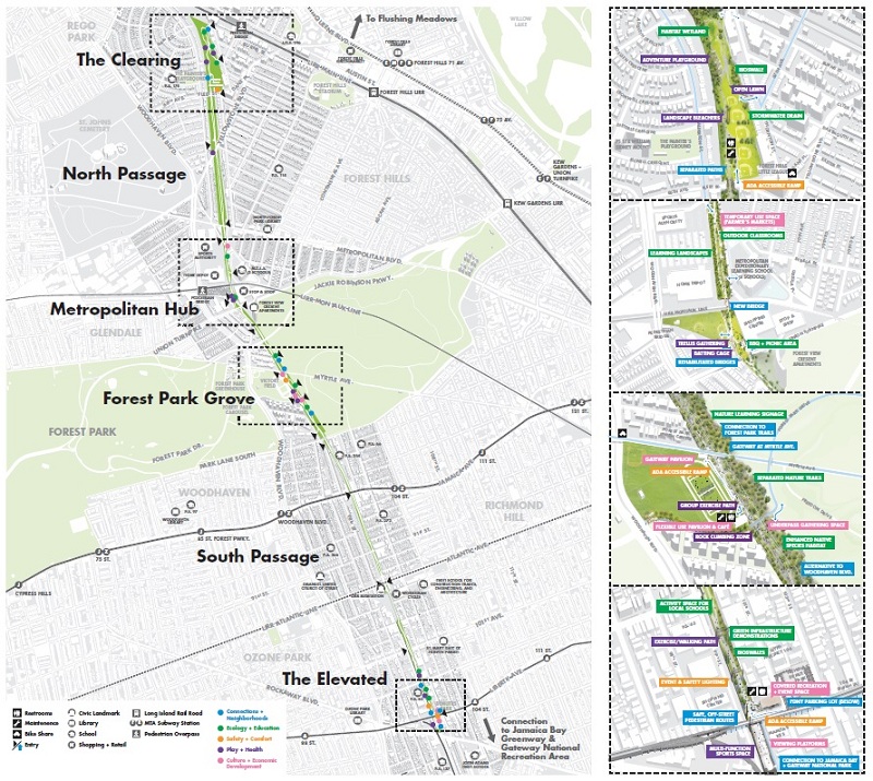 Photo credit: Friends of the QueensWay
The Queensway’s boosters see the locale’s relative modesty as both a blessing and a challenge. Susannah Drake, the principal of DLANDstudio, sees the park conversion as a matter of equity. Locals not only deserve more space for recreation, she says, but safer pedestrian and cycling routes as well. It will be a “High Line for real people” she hopes, where dogs, bikes and strollers are all welcome.
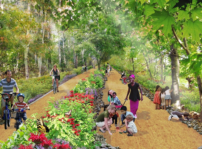 Photo credit: Friends of the QueensWay
But as a lower-income neighborhood with less visibility than West Chelsea, it has been a challenge to find committed fundraising partners and to drum up the kind of publicity the High Line benefited from. In 2013 the group got $470,000 from New York State, allowing for a series of community workshops and a schematic design from DLANDstudio.
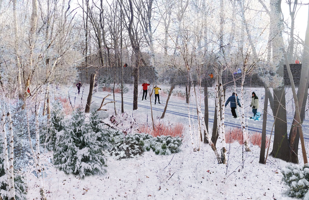 Photo credit: Friends of the QueensWay
So far, the Queensway has secured $2 million from private and public sources for work on the first phase, a central half-mile gathering spot dubbed “Metropolitan Hub.” Plans include outdoor nature classrooms, food concessions, batting cages and a playground. But first they must convince the city, which owns the site, that the Queensway is the best use for the site. That will be the easy part.
Join us in April and May for our upcoming behind the scenes tours of the rail line that may become the Queensway: